General information
The Krzyżanowice commune is located in the Racibórz poviat, in the south-western part of the Silesian Voivodeship. It covers an area of 69 km2 and has about 10.9 thousand sq. m. inhabitants. The commune consists of 10 villages: Krzyżanowice, Chałupki, Tworków, Bieńkowice, Bolesław, Owsiszcze, Nowa Wioska, Roszków, Rudyszwałd and Zabełków. From the east, the border of the commune is the Odra River, while from the south-west it borders with the Czech Republic.
The Krzyżanowice commune is a typical agricultural commune. The commune owes its agricultural character primarily to the high bonitation of the soil. This is favored by a mild, moderate climate, shaped by air currents associated with the close vicinity of the Moravian Gate. This type of climate is optimal for agricultural production.
The contemporary Krzyżanowice Commune is a beautiful and well-maintained place, drowning in greenery, which is characterized by:
- numerous road connections with the Czech Republic (A1 motorway)
- proximity to such cities as Racibórz, Rybnik, Bohumin and Ostrava
- developed health care, a network of schools and kindergartens, and administration
- modern sports facilities, and numerous bicycle routes with a total length of approx. 70 km
- a rich ritual year and a calendar of cultural and entertainment events organized in picturesque and appropriately adapted places.
The Krzyżanowice commune creates not only excellent conditions for living, but also for weekend relaxation and investing, so it is worth visiting and getting to know our commune!
History
The lands on the upper Oder date back to the history of the Stone Age. Stone tools dating back to 240,000-180,000 BC were discovered in the Krzyżanowice commune, which are the oldest traces of human presence in present-day Polish lands. The first written records of most of the villages in the Krzyżanowice commune date back to the 12th and 14th centuries.
Over the centuries, the area of the commune belonged alternately to Poland, Bohemia, Habsburgs, Prussia, Germany, and from 1945 again to Poland. The complex history of this land has given it a rich, multicultural character with elements of Polish, Moravian (Czech) and German culture. Due to its location, it was a place of marches of many armies, e.g. Swedish and Danish troops during the Thirty Years' War, but also the march of King John III Sobieski's troops rushing to the rescue of Vienna.
The end of the Silesian Wars and the Seven Years' War (1763) meant that the local lands became part of the Prussian state for a long time.
After World War I, major territorial changes took place. Pursuant to the Treaty of Versailles of 1919, the entire area of the Krzyżanowice commune was covered by a plebiscite. The sympathies of the inhabitants were divided and, by the decision of the winning coalition, all the villages that are today part of today's Commune were granted to the German state. After the area of the Krzyżanowice commune was occupied in April 1945 by the Soviet army and the Czechoslovak armored brigade, these lands were granted to the Polish state. At the beginning, the entire commune belonged to the then Silesian Voivodeship, and in 1950, as a result of the administrative reform, it was included in the newly created Opolskie Voivodeship. Another administrative reform carried out in 1975 makes the Krzyżanowice commune return to the boundaries of the Katowice Voivodeship, and then in 1999 to the Śląskie Voivodship.
Nature
In the Krzyżanowice commune, there are areas protected by the Natura 2000 program (Las Tworkowski and Border Meanders of the Oder River) and numerous historic woodlots, consisting of both single trees and entire complexes, constituting parks around old castles and palaces. In addition to the magnificent trees, particularly impressive erratic boulders, which are the remnants of the glacier, deserve to be called natural monuments.
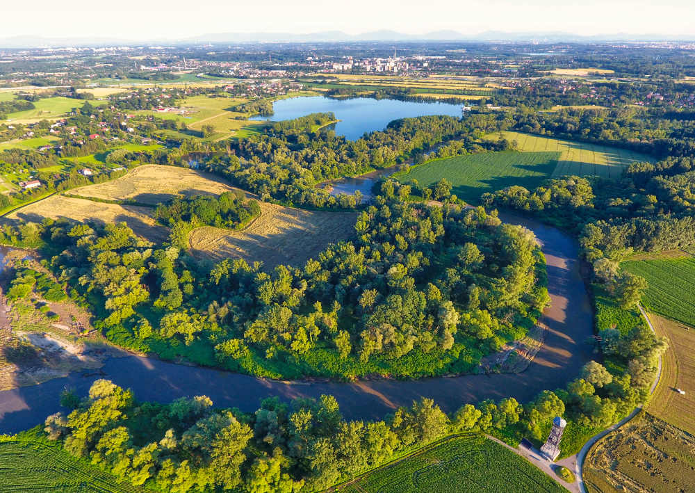
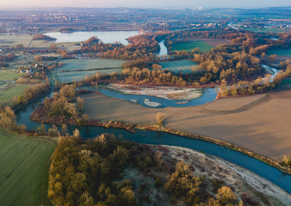
Meanders of the Oder
The Meanders of the Oder River is a unique area of protected flora and fauna on a European scale, entered into the European network of NATURA 2000 Protected Areas. It is a place where nature has retained its pristine character, and the river bed was shaped by nature, not human activity. You can get to know this extraordinary refuge of nature and its inhabitants both by means of a bicycle path that runs through the entire area, as well as from the perspective of the river, during a canoeing trip or from a 27-meter observation tower.
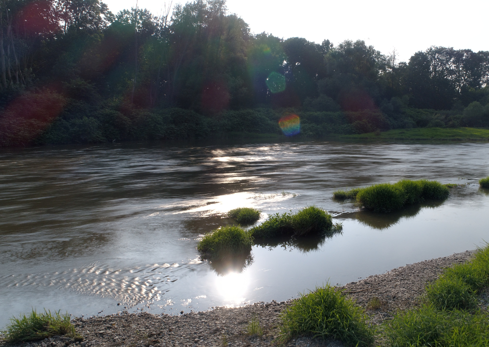
Odra river
The second largest river in Poland has its source on the south-eastern slope of the Fidlův kopec hill in the Oder Mountains, at an altitude of 634 m above sea level. near the village of Kozlov. The river is 854.3 km long, of which 742 km is in Poland.
Fauna and Flora
The fauna of the Border Meanders of the Oder River is rich in rare and protected animal species. Here you can meet badgers, beavers, golden eagles, kingfishers, tree frogs. In the water itself live fish such as chicks, rhododendrons, mussels and mussels. In the rotten branches of old trees, we can meet the hermit beetle (Osmoderma eremita), which is under strict legal protection and is a priority species of the so-called EU Habitats Directive 92/43/EEC. On the border meanders of the Odra River, there are several rare plant communities that are protected on a European scale, including: riverside forests with black alder and ash, willow and poplar riparian forests and fragments of wet meadows. On the other hand, the protected aquatic plants include, among others: water caltrop, lesser lake water lily, northern water lily, lake relish, umbellate joint and rice moth.
")
")
")


